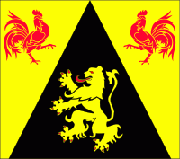
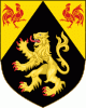
Walloon Brabant (Province du Brabant Wallon)
 |
 |
The provincial population was recorded at 403,599 as of January 2019, giving a population density of 368 /km2.
Walloon is a Belgian version of a old West Germanic word reconstructed as *walh (“foreigner, stranger, speaker of Celtic or Latin”). Brabant is from Old Dutch *brākbant (attested in Medieval Latin as pāgus brācbatensis, Bracbantum, Bracbantia), from Frankish, a compound of Proto-Germanic *brēk-, *brekaną (“fallow, originally 'to break'”) + *bant-, *bantō, *banti (“district, region”)
Like the terms "Belgium" and "Flanders", the terms "Walloon" and "Brabant" are much older than the modern political entities which they represent today, but were already being used in the region when political boundaries were different. For example, Louis de Haynin wrote as follows in 1628:
* The Belgian [region (contrée or province)] is a large country (pays) between France, Germany and the North Sea. This country is typically divided into two regions [régions] which are about equal, which is to say, Belgian Wallonia and Belgian, or according to some, Flemish Germany [belge wallonne et belge allemagne ou flamande, selons aucun]."
De Haynin noted that the distinction people made in his time between Walloon and German or Flemish Belgium was apparently based upon language, with the Walloons speaking French, and the others speaking what he described as a type of Low German (un bas alleman) which people, especially foreigners, referred to as Flemish. Among the provinces within these two large Belgian regions he contrasted "French or Walloon Flanders", now largely within France, with the rest of "Flanders", and "Lothier or Walloon Brabant (brabant wallon)" with the larger "German or Flemish" part of Brabant, which at that time stretched into what is now the Netherlands. Note that for de Haynin and his contemporaries "Belgium" was much larger than modern Belgium, corresponding to the old Burgundian Netherlands and its associated church-ruled principalities. "Belgium" therefore included all of the Netherlands and Luxembourg, and a part of France. In contrast, the term "Flanders" could be used for a smaller region than today, equivalent to the region once dominated by the County of Flanders, near the north sea. As already noted, de Haynin himself used the adjective "Flemish" to refer to the Dutch language, including dialects outside the old Flemish region, but he noted that the term "Flemish" was now being used to cover a bigger area than it originally applied to, because of the prestige of the old medieval county, which was also well-known to foreigners.
Map - Walloon Brabant (Province du Brabant Wallon)
Map


Country - Belgium
 |
 |
| Flag of Belgium | |
Belgium is a sovereign state and a federal constitutional monarchy with a parliamentary system. Its institutional organization is complex and is structured on both regional and linguistic grounds. It is divided into three highly autonomous regions: the Flemish Region (Flanders) in the north, the Walloon Region (Wallonia) in the south, and the Brussels-Capital Region. Brussels is the smallest and most densely populated region, as well as the richest region in terms of GDP per capita. Belgium is also home to two main linguistic communities: the Flemish Community, which constitutes about 60 percent of the population, and the French Community, which constitutes about 40 percent of the population. A small German-speaking Community, numbering around one percent, exists in the East Cantons. The Brussels-Capital Region is officially bilingual in French and Dutch, although French is the dominant language.
Currency / Language
| ISO | Currency | Symbol | Significant figures |
|---|---|---|---|
| EUR | Euro | € | 2 |
| ISO | Language |
|---|---|
| NL | Dutch language |
| FR | French language |
| DE | German language |